
Project Resources
Related Documents
- Lebanon Hazard Mitigation Plan Update 2016
(PDF, 5.7 MB) - Lebanon Hazard Mitigation Plan-2010
(PDF, 6.7 MB) - Lebanon Hazards and Critical Facilities Map
(PDF, 414 KB) - Lebanon Hazardous Materials Map
(PDF, 434 KB) - Lebanon Flood Plain Map
(PDF, 520 KB) - Lebanon Erosion Potential Map
(PDF, 451 KB) - Lebanon Dam Failure Map
(PDF, 443 KB) - Lebanon Boston Lot Dam Failure Map
(PDF, 394 KB)

UVLSRPC Projects
Project Administrator:
Victoria Davis
Project Title:
Lebanon Hazard Mitigation Plans
Related Services:
Project Summary:
Natural and human made hazards plague every town, but if they prepare in advance, the town can reduce or prevent damage.
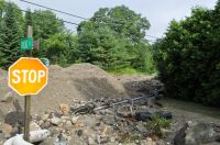
The Upper Valley Lake Sunapee Regional Planning Commission worked with the City to form the Lebanon Hazard Mitigation Committee for the purpose of updating the existing plan to include most recent hazard events such as flooding and erosion as well as meeting the most current State and Federal planning requirements. The Committee brainstormed with the Commission on various ways to mitigate potential hazards such as replacing inadequate culverts to prevent road wash outs during storms.
The NH Homeland Security and Emergency Management contracted with the Commission to complete an update of the hazard mitigation plan for the Town of Lebanon. NH HSEM requires that plans be updated every five years.
Additional Information
Funders:
- Federal Emergency Management Agency, Pre-Disaster Mitigation Planning through NH Division of Homeland Security & Emergency Management

