

Quick Links
Regional Corridor Transportation Plan
Upper Valley Strong COVID-19 Regional Info/Assistance
UVLSRPC Household Hazardous Waste Website
UVLSRPC Waste Management Website


Follow Us on Social Media!
Project Resources
Related Documents
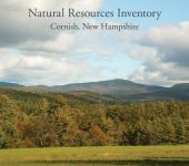
- Cornish Natural Resources Inventory
(PDF, 2.2 MB) - Map 1. Topography
(PDF, 1.2 MB) - Map 2. Protected Lands
(PDF, 473 KB) - Map 3. Water Resources
(PDF, 819 KB) - Map 4. Groundwater Aquifers
(PDF, 458 KB) - Map 5. Agricultural Soils
(PDF, 678 KB) - Map 6. Forest Soils
(PDF, 1.3 MB) - Map 7. Wildlife Habitat Types
(PDF, 795 KB) - Map 8. State Wildlife Habitat Ranking
(PDF, 674 KB) - Map 9. Cultural Resources
(PDF, 478 KB) - Map 10. Surficial Geology
(PDF, 443 KB) - Map 11. Cooccurrence Analysis
(PDF, 2.1 MB)
Related Photographs
UVLSRPC Projects
Project Administrator:
Rachel Ruppel
Project Title:
Cornish Natural Resources Inventory (NRI)
Related Services:
Land Use Planning, Natural Resources
Project Summary:
Upper Valley Lake Sunapee Regional Planning Commission (UVLSRPC) worked with the Cornish Conservation Commission to publish a Natural Resources Inventory, updating the original 1976 inventory.
The Commission developed a series of maps of the vital natural resources in Cornish, NH, and developed a basic inventory of readily available information on natural resources. The Commission also developed a cooccurrence analysis that identified areas where several natural resources overlap.
The Cornish Conservation Commission worked in subcommittees to review the report and added local information to improve and expand the inventory. The Conservation Commission also developed an action plan to promote land conservation and stewardship in town.
The Natural Resources Inventory and associated maps are available for viewing online and downloading - please use the links on the sidebar to access these documents.
Additional Information
Funders:
- Town of Cornish